Why is snow tricky to forecast?
Most of us in the UK love the snow as it is a relatively rare experience, can look stunning across our landscapes and is a little bit of fun for the kids. However, for weather analysts and weather dependant operators like AccuGrit, forecasting the white stuff can be challenging to predict…so here’s a brief look at why:
Atmosphere Temperatures:
Throughout most of the year, a one-degree difference in temperature can make no distinction to our daily lives or any weather events. However, in the depths of winter, that one degree can be the difference between a soggy morning walk with the dog or awakening to beautiful picture postcard white scenery.
To predict snow, the whole temperature profile of the atmosphere, from the ground to the clouds, needs to be understood as it has a significant impact on whether snowfall will happen or not. For example, most rain starts life as snow melting as it drops through the atmosphere; however, in winter, this precipitation can melt, freeze, thaw and refreeze throughout its journey of reaching the ground.
Precipitation Intensity:
This plays a critical role in snowfall success! When falling snow turns into rain, it absorbs heat energy from the air, so the heavier the precipitation, the more heat is absorbed, thus reducing the air temperature. It can get so cold when this happens that the rain stops melting, and we have a snowfall.
Timing (time of day and year):
If a weather front appears at dawn (the coldest part of the day) in winter, we are more likely to see snow than a couple of hours later when the air temperature has warmed up a little from the sun.
Geography:
Ground elevation also plays a part in creating the perfect environment for snow. This is because you are more likely to see snow on the higher land of the hills and mountains of Scotland than on the flat, lower landscape of East Anglia. This is because the higher you are, the less opportunity there is for snow to melt, and it is colder, the higher you go.
So, when weather analysis reviews the atmosphere’s temperature profile, they must consider the geography, and for impact predictions, they will examine the elevation of roads or bridges in the area.
Ground Temperature:
Ground temperature helps us predict how long the snow will stick around. For example, if we receive snowfall in Autumn, the ground is still relatively warm from the summer; comparatively, in February and March, the sun is starting to get stronger and thus, it will warm the ground up quicker.
So, it is a challenge, especially in this country with our landscape, to accurately predict snowfall, with so many factors requiring consideration and all of them susceptible to quickly changing.
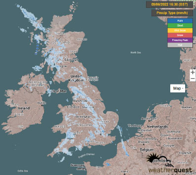
Therefore, it highlights the importance of why we have our team monitor live weather conditions 24/7 from our control room using our weather radars and live cameras and sensors. It enables us to constantly watch what is happening at a location to more accurately support our clients by proactively responding to immediate weather changes or withdrawing services and saving resources when it becomes unnecessary.
To find out more about our technology and services, contact the team at: [email protected]


